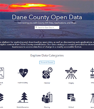
Open Data Portal was created to provide GIS data free of charge to citizens and businesses. It is also the access point to Dane County GIS applications, web maps, and story maps
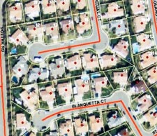
Fly Dane 2017 - countywide color 6-inch resolution imagery
One-foot interval contours development based on the 2017 Fly Dane Imagery
Created GIS viewers for county assessors and county clerks
Developed a Planning Viewer that displays GIS layers and provides analysis tools for the Planning Department
Fly Dane 2014 - countywide color 6-inch resolution imagery
Consolidated Boundary & Annexation Survey (CBAS) submittal to US Census and Wisconsin Legislative Technical Services Bureau (LTSB)
Building footprint update based on the 2014 imagery
LIO & 911 Communication TIME Award - Dane County (LIO & 911), WisDOT and state contractors to work in cooperation sharing centerline data for the Verona Road Project that provided best routing methods for emergency responders during the various phases of the project
Contribution to ESRI Community Maps program
Developed a Land and Water Resources Viewer for the Land Conservation Department
Migrated DCiMap to an in-house deployment and maintenance thus saving the county thousands of dollars annually
Implemented Surveyors Office which allows surveyors to view images of plats, surveys, and tie sheets by selecting on a map
To help the public find where they should vote, we crated an Elections Polling Place online application
A Parks Finder mapping application was introduced to help users search nearby parks and explore their amenities
Using ArcGIS Online we published numerous maps including Bike Trails, Supervisory Districts, School Districts, Cross Country Ski Trails, and a Dane County Wall Map
Developed a Public Notification online mapping tool to create mailing labels of a buffered parcel
Enhanced the parcel and zoning maintenance application and process to take advantage of the new ESRI software package
Developed a GIS data view tool (DCView) to provide access to Dane County's GIS data to county departments
Assisted with the development of a strategic plan for the use of GIS in the 911 Center
Updated county board supervisory district mapping
Implemented online services for public access to GIS and county data (DCiMap)
Enhanced 2000 roadway data set to include private roads, identification of roadway type, and road names
Developed a workplan to migrate the county from a department-centric GIS to an enterprise system, including upgrades to a new generation of GIS software products and an improved technology infrastructure
Assisted with GIS-based analysis and mapping for advanced life support response planning
Assisted with the development and implementation of a lake property numbering system for emergency response
Assisted with geographic analysis of Yahara Lakes flooding and Lake Mendota floodplains
Implemented online access to County Surveyor records for professional surveyors, including geodetic control and PLSS corner information
Our First 20 Years…
Developed a regional inventory of GIS staff and available data and applications
Developed a traffic incident mapping application (reporting and analysis) for the Sheriff's Department
Developed a central online catalog of county map products (Dane County Map Catalog)
Assisted with the development of rural town land use planning maps (Dane County Map Book)
Competed development of GIS-based tax parcel and zoning mapping
Formed the Fly Dane regional partnership for aerial photography and related product acquisition, including a funding mechanism to offset future acquisition costs. Fly Dane 2000 prodcued 1-foot resolution digital orthophotography countywide, 6-inch orthophotography in urbanized area, a more detailed terrain model, 4-foot contours, hydrography and roadway vectors, and survey control network enhancements. Fly Dane 2003 acquired 6-inch resolution orthophotography in limited areas. Fly Dane 2005 producted 1-foot resolution digtial orthos county-wide, 6-inch orthos in urbanized areas, and 2-foot contours.
Developed a workplan to migrate the county from a department-centric GIS to an enterprise system, including upgrades to a new generation of GIS software products and an improved technology infrastructure
Updated the Dane County Land Records Modernization Plan and developed a companion strategic plan
Implemented new post-Y2K online services for access to geographic and land information, and municipal address data exchange (AccessDane)
Completed Y2K conversion of real property, tax, and zoning systems
Formed GIS user group for county department and regional project coordination and information sharing
Developed FGDC-complaint metadata for enterprise geospatial data sets
Established data distribution policies and procedures to support GIS/LIS data sharing with public and private entities
Implemented document imaging and indexing in the Register of Deeds Office. Information is accessible online and via public access computer terminals in county offices.
Developed mainframe zoning permit system to manage permit issuance, schedule inspections, and track violations and conditional use permits
Developed mainframe real property listing system to maintain real property and assessment information, including public county terminals for access to tax roll information
Provided assistance to municipal and other local agencies for Wisconsin Land Information Program grant application and project planning
Created or acquired numerous GIS data sets for county and public use, including tax parcel maps, soils, wetland, roadways, hydrology, EMS/fire districts, Sheriff precincts, supervisory districts, etc.
Implemented GIS hardware and software in county offices and the Regional Planning Commission; provided user training, advice, and support